

A Local’s Guide to DeSoto State Park, Part 3: The High Ground
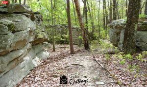
Last month, we explored the park’s waterfall corridor. This month, we move to higher ground, where the terrain and atmosphere shift.
Explore the mountain’s rolling crest on the White Trail
An old path that follows the contour of Lookout Mountain, the White Trail seems longer than its 2-mile length due to rolling elevation changes and the variety of forest settings. Expect to see ravines filled with tall hardwoods, large sandstone formations, and wildlife along the way. The western end of the trail sits near the park’s highest elevation, roughly 300 feet higher than the eastern end.
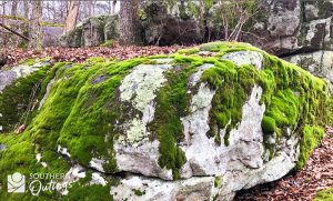
Hikers and mountain bikers share this trail. A rock quarry along the western portion supplied stone used by the Civilian Conservation Corps to build park structures in the 1930s and 1940s.
Listen for woodpeckers and watch for deer, especially near the ravines. Walking beneath tall canopies in these areas can be as stirring as the sights and sounds of the river.
Dissect the upper terrain on the Silver Trail
The Silver Trail runs east to west along higher ground, paralleling the road rather than the stream. It loops near the RV campground and passes through dense forest on gentle slopes.
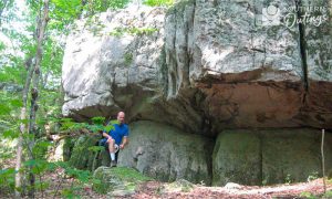 This trail offers a good opportunity to observe changes in vegetation and elevation, as well as birdlife, including woodpeckers, tanagers, and buntings.
If you go
These trails provide a quieter, less water-focused experience, highlighting the broader landscape of Lookout Mountain.
Next month, we’ll wrap up the series with a look at shorter hikes and one of Alabama’s most iconic waterfalls.
For more trail guides, photos, and maps, visit Tim’s website at southernoutings.com.
Mentone Fall Festival Returns Saturday, Oct. 17
Lots of Good Food Choices and Opportunities to Sponsor Mentone is preparing to welcome thousands of visitors as the Mentone Fall Festival returns Saturday, Oct. 17, for a full day of art, music, food, and » Read More

High Temps? No Problem. Try These Cool Recipes
We’ve been spoiled most of the summer with rainy days, cloud cover, and highs in the 70s and low 80s. But today when I walked outside, I realized that luck might have run out. Corn » Read More

Valley Head Women’s Club Awards Scholarships
The Valley Head Area Women’s Club awarded two scholarships to the Valley Head High School Class of 2026. This year, the scholarships were increased in memory of JoAnn Phillips to a total value of $800 » Read More

A Bit of Our Town’s History
I decided to give you all a brief history lesson on our beautiful town this month. I even discovered a new fact or two myself. Valley Head was officially incorporated in 1922 and continues to » Read More